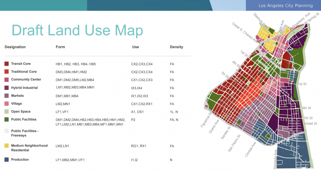
The above map is a draft version of the Downtown Los Angeles Map of Land Use and Zoning. On the left is the Financial Distict and South Park while on the right is the Warehouse District and Arts District.
The City Planning Commission is updating the Downtown Plan for future growth and changes in land use. The new plan will set a new direction for the future of DTLA to guide the physical development of neighborhoods, and establish goals and policies for land use in addition to a range of planning topics, including streets and open space, urban design, mobility, and arts and culture.
Heavy Industrial zoning would be removed. A new Hybrid Industrial Zone would dominate in the Arts District.
In the upper right section the Cornfield Arroyo Seco Specific Plan (CASP) area encompasses a large area sometimes known as the North Industrial District. Older generations may refer to it as part of Chinatown or Dogtown.
In a June 14, 2021 letter by the Chinatown Stakeholders to the Planning Commission, CASP was addressed per the below excerpt which is somewhat critical.
In the Cornfield – Arroyo Seco Specific Plan (“CASP”) adopted in 2013, City Planning attempted to promote infill development in the CASP area but also sought to limit the percentage of residential space in the floor area of new projects. This had the unintended effect of discouraging new development even at a time when other parts of the Central City were experiencing a development boom. The only project within the CASP area that has been approved since adoption of CASP (1457 N. Main St., with 244 live/work units) moved forward only as a result of the Central Area Planning Commission granting (in May 2020) an exception from CASP’s limitation of residential uses not exceeding 15 percent of the floor area. The City Council subsequently approved Councilmember Cedillo’s motion (Council File No. 13-0078-S2) directing City Planning to review the land use incentives in CASP to determine whether they had the net effect of discouraging the production of mixed-income housing.
In addition to the above commentary, the Shimoda Design Group submitted its criticism of the draft plan as per below excerpt:
The draft plan website states “Several years ago, City Planning set out to create a modern and efficient zoning system for Los Angeles. The proposed approach aims to establish a new Zoning Code that is more responsive to the needs of Los Angeles’s neighborhoods, in addition to being easier to use.”
These are noble goals, but the current draft of the code does not show itself to be more responsive to local needs, nor is it easier to use. We believe that the zoning sections regarding Form, Frontage, Standards & Use and Density are too prescriptive and need to be revised to allow for creativity and diversity in aesthetics and construction. As it stands this document is too granular and contains many contradictions in its prescription. The density and the complexity of the current version will create an administrative nightmare for the city in its implementation and interpretation. Many of the prescriptions for dimensional minimums and maximums are not reflective of real market conditions and place unnecessary limitations on creativity. The code will inadvertently create requirements that will effectively neuter Los Angeles as a competitive and desirable place to invest in. The result will negatively impact the future of Los Angeles.
We strongly believe that the current draft needs further revisions and input from the professional design and development community prior to adoption. The draft analysis of the Downtown, Arts District, Little Tokyo, and Chinatown districts in particular need to be reconsidered and not be defined by transitory cultural associations, a form-based code or by prescribed use requirements that will not evolve over time to reflect the community that it serves. We strongly believe and support the up zoning of all of these areas to increase density and affordability.
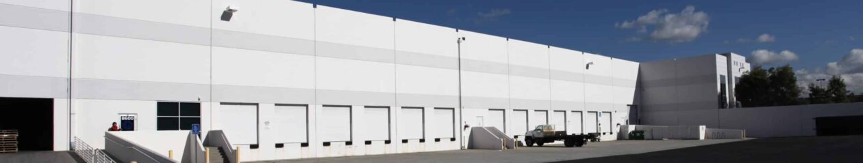
The CASP is a land use document that governs a 600-acre industrial area interspersed with clusters of residential neighborhoods, commercial activity, City-owned land, affordable housing developments, and open spaces, such as the Los Angeles State Historic Park (the “Cornfield”). The area contains 3.7 million square feet of industrial space—the most
prevalent use in the CASP—of which 74 percent is used for warehousing, storage, or distribution. There are about 1,800 dwelling units in the CASP, three-quarters of which are in multi-family buildings, totaling about 6,200 residents.